
Summary
A sudden change in weather has brought much-needed relief to Chandigarh, Punjab, and Haryana after a week of extreme heat. Early Tuesday morning, thunderstorms and rain moved across the region, breaking a heatwave that had lasted since April 20. While the cooler air is a welcome change, weather officials have issued an orange alert for the next 24 hours due to the risk of lightning and strong winds. This shift marks the end of a period where temperatures consistently stayed above 40 degrees Celsius.
Main Impact
The primary impact of these showers is a significant drop in daily temperatures across the entire region. For over a week, residents faced a punishing dry heat that felt like being in a furnace. The arrival of rain has not only cooled the air but also increased humidity levels, making the environment feel much more comfortable. In many cities, the maximum temperature dropped by as much as 6 degrees Celsius in just one day. This change has helped lower the demand for electricity and provided a break for people working outdoors who were struggling with the record-breaking heat.
Key Details
What Happened
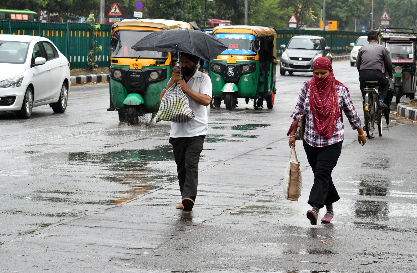
In the early hours of Tuesday, the weather took a dramatic turn. Residents who had been suffering through bone-dry days woke up to dark clouds and the sound of rain. The storm brought lightning and winds that blew at speeds between 50 and 60 kilometers per hour. This weather event was caused by a change in atmospheric conditions that finally pushed away the hot air sitting over the plains of North India. While the rain was light in some areas and scattered in others, it was enough to completely change the local climate.
Important Numbers and Facts
The data from the weather office shows just how extreme the change was. In Chandigarh, the highest temperature on Tuesday was 33.8 degrees Celsius. This was a massive drop from Monday’s high of 40.2 degrees Celsius. Interestingly, the night before the rain was the warmest of the entire season, with a low of 24.8 degrees Celsius. Humidity levels, which had been as low as 12 percent during the heatwave, jumped up to 71 percent on Tuesday morning. In Punjab, the average high temperature fell by 6 degrees, while Haryana saw a drop of about 3.7 degrees. Some cities like Patiala and Gurdaspur recorded around 8 millimeters of rain, which helped settle the dust and cool the ground.
Background and Context
This weather shift is important because the region had been trapped in a severe heatwave for seven days. Starting around April 20, temperatures began to climb well above what is normal for this time of year. In some parts of Punjab, such as Faridkot, the heat reached a dangerous 45.2 degrees Celsius. In Haryana, cities like Rohtak saw temperatures hit 44.6 degrees multiple times. These conditions are not just uncomfortable; they can be dangerous for health and difficult for farmers. The sudden arrival of rain at the end of April is a typical but very necessary part of the seasonal transition, helping to prevent the ground from drying out too quickly before the peak of summer.
Public or Industry Reaction
The reaction from the public has been one of great relief. Social media was filled with pictures of the rain and dark clouds as people celebrated the end of the 40-degree days. For many, the cooling breeze was a sign that they could finally turn off heavy air conditioning for a few hours. However, the weather office has warned people to stay cautious. The orange alert means that while the rain is good, the lightning and strong winds can still cause damage to trees, power lines, and temporary structures. Farmers are also keeping a close eye on the weather, as strong winds and rain can sometimes affect crops that are ready for harvest.
What This Means Going Forward
The cooling trend is expected to last for most of the coming week. The weather office predicts that temperatures will stay between 35 and 38 degrees Celsius over the next few days, which is much more manageable than the previous week. Wednesday and Thursday will likely see more thunderstorms and light rain. Friday is expected to be the only dry day of the week before the clouds return on Saturday. This pattern of scattered rain and clouds will likely keep the extreme heat away through the first week of May. Residents should prepare for occasional power disruptions if the winds remain strong, but the overall forecast is much more positive than it was a week ago.
Final Take
The recent rain has successfully ended a dangerous period of extreme heat across Chandigarh and the surrounding states. While the storms bring their own set of challenges, such as strong winds and lightning, the drop in temperature is a vital change for the region. As long as the current weather pattern continues, the intense heat of late April will remain a thing of the past, giving everyone a chance to breathe easier as May begins.
Frequently Asked Questions
How much did the temperature drop in Chandigarh?
The maximum temperature in Chandigarh dropped by 6.4 degrees Celsius in a single day, falling from 40.2 degrees on Monday to 33.8 degrees on Tuesday.
What does an orange alert mean for the weather?
An orange alert means that residents should be prepared for bad weather. In this case, it refers to the possibility of thunderstorms, lightning, and winds reaching speeds of up to 60 kilometers per hour.
Will it continue to rain for the rest of the week?
Rain and clouds are expected on Wednesday, Thursday, and again over the weekend. Friday is currently the only day forecast to be dry and clear.