
Summary
A new weather system known as a western disturbance is arriving in the Himalayan region tonight. This system will bring significant changes to the weather in Chandigarh, Punjab, and Haryana over the next week. Residents should prepare for rain, lightning, and strong winds. While the rain will help lower the recent high temperatures, it also brings risks like hailstorms that could damage crops and property.
Main Impact
The most immediate effect of this weather change will be a break from the intense heat. Weather experts predict that temperatures will drop by 3 to 4 degrees Celsius in the coming days. However, the shift brings its own set of dangers. The India Meteorological Department (IMD) has issued alerts because of the potential for heavy rain and hail. Strong winds, reaching speeds of up to 60 kilometers per hour, are expected to hit several areas, which could lead to power outages or damage to weak structures.
Key Details
What Happened
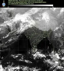
The weather started to change on Saturday, though most areas remained dry. Chandigarh saw a small rise in temperature, reaching 36.2 degrees Celsius, which is still slightly cooler than what is normal for this time of year. However, the arrival of the western disturbance tonight marks the start of a much more active weather pattern. This system is moving in from the mountains and will spread across the plains of Punjab and Haryana by Sunday morning.
Important Numbers and Facts
The IMD has set up a color-coded alert system to help people stay safe. For Sunday, a yellow alert is in place, meaning people should stay updated on the weather. On Monday and Tuesday, the situation becomes more serious with an orange alert. During these two days, winds could blow as fast as 50 to 60 kilometers per hour. Rainfall is expected to be widespread, marking the most significant rain event since late April. In Chandigarh, the seasonal rainfall since March has already reached 75.7 mm, which is over 135% higher than the usual amount for this period.
Background and Context
A western disturbance is a type of storm that starts near the Mediterranean Sea. It brings sudden winter or pre-monsoon rain to the northwestern parts of India. These systems are very important because they provide water for crops, but they can also be destructive if they bring hail. This year, the region has seen more rain than usual, which has kept the extreme summer heat away for longer periods. For example, cities like Hisar and Bathinda recently saw temperatures around 40 to 41 degrees Celsius, but these are expected to fall quickly as the new storm arrives.
Public or Industry Reaction
The weather department has issued a strong advisory for both the general public and the farming community. People are told to stay indoors during thunderstorms and avoid standing under trees, as lightning and falling branches can be dangerous. Farmers are facing a difficult time because many are currently managing their wheat and other winter crops. The IMD has told farmers to stop all work in the fields during the storm. They have also been advised not to water their crops or spray any chemicals like pesticides right now, as the rain will simply wash them away or the wind will blow them off target.
What This Means Going Forward
The stormy weather is expected to last through most of the week. While Monday and Tuesday will be the most intense days, rain may continue in some spots until Saturday. This means that the typical summer heatwave conditions are unlikely to return anytime soon. By Thursday, the sky might clear up briefly, but the air will remain much cooler than it was at the end of April. Residents should keep an eye on local weather reports, as the intensity of hailstorms can change quickly and vary from one town to the next.
Final Take
The arrival of this western disturbance is a double-edged sword. It offers a much-needed relief from the rising summer heat, making daily life more comfortable for many. However, the threat of hail and high winds poses a real danger to the agricultural sector and local infrastructure. Staying informed and following safety guidelines will be essential for everyone in the region over the next few days.
Frequently Asked Questions
What is an orange alert?
An orange alert means that the weather could become dangerous. People are advised to be prepared for possible disruptions and to take action to stay safe, as heavy rain or strong winds are likely.
How will this weather affect farmers?
Farmers may face crop damage from hail and strong winds. They are advised to stop irrigation and pesticide spraying until the storm passes to avoid wasting resources and damaging their plants.
Will the heat return soon?
According to current forecasts, the rain and clouds will keep temperatures lower than normal for at least the next week, preventing a heatwave from starting in the immediate future.